Archiv der Kategorie: USA

USA 15.2 – Chicago, IL

2023 war ich für ein Jahre in den USA. Jetzt ist es Trumpistan.
Bleibt fern. Besucht lieber Kanada und Mexiko. — And: Don’t buy American.

DEU

Der Tag beginnt, nach einem großen Kaffee, mit ’nem Fußmarsch entlang N Wabash Ave. Das bringt mich direkt zum Trump Tower. Gleich daneben das wichtigere Gebäude; schwarz, unauffällig: Wayne Enterprise. Hier arbeitet Batman.

Zuerst kümmere ich mich um zwei Dinge, die ich gestern übersehen habe: Das Chicago Theater und City Hall. Das Theatre, besser gesagt Kino, ist von 1921. Es ist eines dieser klassichen Gebäude mit einem riesigen vertikalen Schild. Ein absoluter US-Klassiker.1 City Hall ist nur ein wenig älter (1911), aber weniger spektakulär im Anblick. Aber hier kollabierte das Blues Mobile zum Ende des Films.

Nachdem ich die Nachlässigkeit von gestern korrigiert habe, beginne ich den Tag mit einer Bootsfahrt … entlang der gleichen Route wie gestern. Das Schiff in Richtung Lake Michigan startet später. Ich habe Zeit. Das 24-Stunden-Ticket bei Shoreline Sightseeing ist noch ein paar Stunden gültig. Ganz entspannt. Das Ticket war übrigens die beste idee des gestrigen Tages.

Gestern waren es dann doch etliche Kilometer Fußmarsch und heute steht auch einiges auf dem Programm. Da kommt mir die zusätzliche Stunde Bootsfahrt gerade recht. Es geht wie gestern entspannt den Chicago River entlang zur Union Station / Opera House und zurück. Ich genieße die Fahrt. Chicago schlägt New York echt um Längen. Der Chicago River mit seiner Farbe und seinen Brücken macht den Unterschied.

Nach einer Stunde sind wir zurück und ich bleibe sitzen. Das Schiff fährt weiter zum Navy Pier. Hier wechsel ich mit einer kurzen Pause auf das Taxi auf der anderen Seite des Polk Bros Park.Wem „Polk“ jetzt bekannt vorkommt: 4 Touchdowns in einem Spiel!

Wir legen ab vorbei am Chicago Harbor Lighthouse.2 Am Leuchtturm vorbei sind wir jetzt auf dem Lake Michigan. Es geht nach Süden, zur Buckingham Fountain. Hier will ich eigentlich aussteigen. Aber zuerst will ich die ganze Tour genießen. Ich fahre weiter zum Museum Campus und dann zurück zum Navy Pier. Das Personal ist etwas verwirrt, da ich immer noch sitze. Und erneut geht es raus auf den Lake Michigan.

Was ist so besonders an der Buckingham Fountain? Al Bundy, 4 Touchdowns in einem Spiel für Polk High.

Auch ohne den Kontext ist der Springbrunnen einen Besuch wert. Mit den Hochhäusern von im Hintergrund wirkt er noch besser. Von hier wandere ich runter zum Field Museum. Auf dem Weg sind Maßnahmen für den kommenden Feiertag (Memorial Day) in vollem Gange. Viele Wege sind bereits gesperrt. Ich muss Umwege laufen. Hinter dem Museum ist das Soldier Field, das Football Stadion von Chicago.

Ein Planungsfehler lässt mich glauben, dass hier an der 18th Street ein Bahnhof ist, der mir eine Zugverbindung zur Chinatown bietet. Dem ist nicht so. Es wird ein Fußmarsch durch den Prairie District. Die Nachbarschaft ist in Ordnung.

Es dauert eine gefühlte Ewigkeit, bis ich an der S Wentworth Ave bin. Der Fußmarsch ist nicht zur Nachahmung gedacht. Auch Chinatown ist eher weniger spektakulär. Aber wenn ich schon mal hier bin, kann ich auch Mittag essen. Nördlich der Straße mit dem Tor gibt es noch eine kleine Fußgängerzone am Chinatown Square Plaza. Ich war da. Haken an die Liste. Weiter.

Vom Banhhof Cermak-Chinatown geht es zurück nach Downtown. Ich steige kurz vor der Loop am Haltepunkt Harrison aus. Ich gehe zurück zur Buckham Fountain und dieses Mal von hier nach Norden zum Grant Park (Maggie Daley-Par und Millenium Park) verbunden.

Hier steht das(?) … die(?) … Cloud Gate. Die Meisten kennen das Ding sicherlich unter dem Spitznamen The Bean. Die Form soll an einen Tropfen Quecksilber erinnern. Naja. Dann doch eher Bohne. Etwas südlich gibt es die Crown Fountain, eine weitere Kunstinstallation. Da es in der Nähe ist, stoppe ich im Elephant & Crown für ein Ale.

Der letzte Stopp für heute ist das 360 Chicago, genauer gesagt die so benannte Aussichtsplattform in der 94. Etage des John Hancock Center.3 Ich werde es deutlich vor Dämmerung dorthin schaffen. Nicht auf meiner Liste hatte ich den alten Wasserturm am Jane M. Byrne Plaza Park. Den muss ich googeln.

Die Aussicht vom 360 Chicago ist Wahnsinn. Die Großstadt von oben ist immer etwas besonderes.

Ich mache sogar ein Foto von der Sonne. Ich dachte erst, es ist Schmutz auf der Optik, aber es ist wirklich ein Sonnenfleck; AR3310 einer der größten, die in den vergangenen Jahren beobachtet wurden. Mit Penumbra ist er 4 Erddurchmesser groß (grob 51.000 km). Das Zentrum, das was man in meinem Foto sieht, sind etwa 1,5 Erddurchmesser (grob 19.000 km).

Der Eintrittspreis hatte einen Gutschein für einen Drink. Aber Abendessen muss ich mir woanders suchen. Meine Wahl fällt auf das Portillo’s & Barnelli’s. Nach Deep Dish ist es Zeit für ein Chicago Style Hotdog, oder zwei. OK, es ist bei einem geblieben … und eine Philly Cheesesteak.

Zurück im Hotel gönne ich mir noch einen Drink an der Bar, bevor ich ins Bett falle. Weit vor Mitternacht. Morgen muss ich früh los. Es geht mit dem Zug nach Milwaukee.

ENG

After a big coffee, the day starts with a walk along N Wabash Ave. This takes me straight to Trump Tower. Right next to it is the more important building; black, inconspicuous: Wayne Enterprise. This is where Batman works.

First, I’ll take care of two things I overlooked yesterday: The Chicago Theater and City Hall. The theater, or rather movie theater, is from 1921 and is one of those classic buildings with a huge vertical sign. An absolute US classic.4 City Hall is only a little older (1911), but less spectacular to look at. But this is where the Blues Mobile collapsed at the end of the movie.

After correcting yesterday’s negligence, I start the day with a boat trip … along the same route as yesterday. The boat towards Lake Michigan departs later. I have time. The 24-hour ticket from Shoreline Sightseeing is still valid for a few hours. Very relaxed. Incidentally, the ticket was the best idea of the day yesterday.

Yesterday I had to walk quite a few kilometers and today I also have a lot on my agenda. So the extra hour on the boat is just what I need. Like yesterday, it’s a relaxed trip along the Chicago River to Union Station / Opera House and back. I enjoy the trip. Chicago really beats New York hands down. The Chicago River with its color and bridges makes all the difference.

After an hour we are back and I stay seated. The ship continues to Navy Pier. Here I take a short break and change to the cab on the other side of Polk Bros Park. 4 touchdowns in one game!

We sail past the Chicago Harbor Lighthouse.5 Past the lighthouse, we are now on Lake Michigan. We head south to Buckingham Fountain. This is where I actually want to get off. But first I want to enjoy the whole tour. I continue to the Museum Campus and then back to Navy Pier. The staff are a bit confused as I’m still sitting down. And once again I head out onto Lake Michigan.

What’s so special about Buckingham Fountain? Al Bundy, 4 touchdowns in one game for Polk High.

Even without the context, the fountain is worth a visit. It looks even better with the skyscrapers in the background. From here I walk down to the Field Museum. On the way, there are activities in full swing for the upcoming Memorial Day holiday. Many paths are already closed. I have to take detours. Behind the museum is Soldier Field, Chicago’s football stadium.

A planning error leads me to believe that there is a train station here on 18th Street that offers me a train connection to Chinatown. This is not the case. It will be a walk through the Prairie District. The neighborhood is fine.

It takes what feels like an eternity to get to S Wentworth Ave. The walk is not meant to be imitated. Chinatown is also rather less spectacular. But while I’m here, I might as well have lunch. North of the street with the gate, there’s another small pedestrian area at Chinatown Square Plaza. I was there. Bucket list, checked. Next.

From the Cermak-Chinatown station, I head back downtown. I get off just before the Loop at the Harrison stop. I walk back to Buckham Fountain and this time connect north to Grant Park (Maggie Daley-Par and Millenium Park).

Here is the Cloud Gate. Most people certainly know it by its nickname The Bean. The shape is supposed to resemble a drop of mercury. Well. More like a bean then. A little to the south is the Crown Fountain, another art installation. As it’s nearby, I stop off at the Elephant & Crown for an ale.

The last stop for today is 360 Chicago, or more precisely the observation deck on the 94th floor of the John Hancock Center.6 I’ll make it there well before dusk. Not on my list was the old water tower at Jane M. Byrne Plaza Park. I’ll have to google that one.

The view from 360 Chicago is amazing. The big city from above is always something special.

I even take a photo of the sun. At first I thought it was dirt on the optics, but it really is a sunspot; AR3310 is one of the largest that has been observed in recent years. With penumbra it is 4 Earth diameters across (roughly 31.500 miles). The center, what you see in my photo, is about 1.5 Earth diameters (roughly 11.800 miles).

The entrance fee included a voucher for a drink. But I have to find somewhere else for dinner. My choice falls on Portillo’s & Barnelli’s. After Deep Dish, it’s time for a hicago Style Hotdog or two. OK, I only one … and a Philly Cheesesteak.


Back at the hotel, I treat myself to a drink at the bar before falling into bed. Well before midnight. I have an early start tomorrow. I’m taking the train to Milwaukee.

USA 15.1 – Chicago, IL

2023 war ich für ein Jahre in den USA. Jetzt ist es Trumpistan.
Bleibt fern. Besucht lieber Kanada und Mexiko. — And: Don’t buy American.

DEU

Ich bin gestern vor 23:15 Uhr in den Flieger gestiegen und lande kurz nach 5 Uhr auf dem Flughafen O’Hare. Der Weg zur CTA ist leicht, der Ticketkauf etwas verwirrend. Vor mir liegen 43 Minuten fahrt in die Innenstadt. Wäre da nicht eine Baustelle und Schienenersatzverkehr. Das fängt ja gut an. Keiner hat einen Plan. Naja, so lerne ich die Außenbezirke von Chicago kennen. Den letzten Abschnitt in die Innenstadt geht das dann wieder mit dem Zug.

Ich steige Clark/Lake aus. Ab jetzt gilt, wie in New York, Schachbrettmuster: Ich muss 5 Straßen und einen Fluss nach Norden und drei nach Osten. Ich laufe etwas zickzack, damit es nicht langweilig wird und sehe bereits die ersten „Wahrzeichen“. Die Stadt wacht gerade erst auf. Es ist Sonntag. In einigen Straßen riecht es nach dem „Dreck“ der vorherigen Nacht. Am Hotel (Freehand Chicago) angekommen parke ich meine Koffer. Auf gehts. Ich bin müde, aber es ist noch nicht einmal 8 Uhr. Der Tag will genutzt werden.

Bereits an der E Illinois St lerne ich, dass man in Chicago in zwei Straßenebenen arbeiten muss. Zwischen N Rush St und N Columbus Drive ist die Straße unterirdisch. Es gibt aber auch einen Abschnitt überirdisch. Der startet an der Michigan Ave und endet kurz vor N Columbus Drive in einer Sackgasse. Zum Glück habe ich keinen Mietwagen gebucht.

Sightseeing beginnt an der Cityfront Plaza. Es sieht hübscher aus als New York: Tribune Tower und Wrigley Buildung, gebaut vermutlich Anfang des 20. Jahrhunderts im Stil der fränzösischen Gothik. Von der Skyline her gefällt mir Chicago schon jetzt.

Ich wechsele an der N Michigan Ave auf die Südseite des Chicago River. Dort ist der „Riverwalk„, der sich den ganzen Fluss vom Hafen (Lake Michigan) bis zur Flussgabelung entlang zieht. Hier holt mich Chicago endgültig ab: Das türkisfarbene Wasser des Chicago River, die Hochhäuser – teils 100 Jahre alt in weißem Marmor, teils hochmodern in Glas und Stahl, die alten Brücken aus Stahl, genietet und rostfarben, in einem Abstand von etwa 100m. Hier treffen die Baustile von 2 Jahrhunderten aufeinander.

Ich schlendere den Riverwalk entlang. Die beiden runden Tower der Marina City; unten Parkplatz oben Apartments. Das Reid Murdoch Building von 1914. Direkt vor dem Gebäude kenterte 1915 die SS Eastland7.

Jetzt kommt die Brücke an der N Wells St. Unten fahren die Autos, oben fährt die U-Bahn. Es ist mein erster Blick auf die Loop8, die viele aus Filmen wie Blues Brothers kennen. Wo wir gerade bei Filmen sind: Der Riverwalk ist direkt am Wasser. Die Straße daneben ist Wacker Drive. Auch diese Straße gibt es auf einer Länge von fast zwei Meilen in zwei Ebenen, bekannt u.a. aus Blues Brothers und Dark Knight.

Über die Brücke an der der N Orleans St geht es wieder auf die Nordseite. Hier an der Flussgabelung enstehen gerade zwei neue Gebäude. Eines davon wird der Salesforce Tower. Mein Ziel ist aber Kinzie Street Bridge, die mit einem anderen Unglück verbunden ist. Chicago ist durchzogen von unterirdischen Versorgungstunneln, die verschiedene Gebäude mit einander verbinden.9Einer der Tunnel verläuft direkt an der Kenzie-Brücke und als man neue Holzpfeiler in die Erde rammte, hat man den Tunnel getroffen. Das Wasser der North Chicago River flutete daraufhin die Keller dutzender Gebäude. Das Unglück ist bekannt als „Chicago Flood„.

Auf der Westseite gehe ich nun nach Süden, vorbei am River Point Park und runter zum Civic Opera House. Es wird Zeit für Mittagessen und ich brauche Sonnencreme. In Monterey ist die Gefahr eines Sonnenbrands vorhanden aber vergleichsweise gering. Hier in Chicago ist Sonne pur, keine Wolken. Bestes Wetter und ja, ich mutiere langsam in einen Hummer. Mein Ziel ist auch schon bekannt: Lou Malnati’s [weblink] an der N Wells St, bekannt für die Chicago Style Deep Dish Pizza. Diese Pizza hat einen extrem dicken Teig, sie ist eher ein Kuchen mit Pizzabelag. Ich empfehle nur ein Stück zu bestellen. Woher ich Lou Malnati’s kenne? Der Nostalgia Critic (Doug Walker) hat es ein paar Mal erwähnt.

Ich setzte meine Rundreise fort. Es geht am Südarm der Chicacgo River weiter. Hier steht der massive Klotz des „Civic Opera Building“. Daher versuche ich irgendwie einen Blick auf den Willis Tower zu erhaschen.Ich laufe etwas an der Loop entlang. Hier finde ich auch eine Feuerwehrwache. Durch Zufall bekommen die gerade einen Alarm und rücken aus.

Nun ist es Zeit für eine Fahrt mit der Loop Line. Das Bahnsystem ist alt. Alles ist aus genietetem Stahl. Es rumpelt. Es rattert. Es ist ein Abendteuer, von LaSalle/Van Beuren bis nach State/Lake. Von hier sind es nur ein paar Meter bis zum Fluss … und den Ausflugschiffen. Pause für die Füße klingt gut. Ich buche ein 24-Stunden-Ticket bei Shoreline Sightseeing. Es ist keine Sightseeing Tour, sondern das Tagesticket für das Water Taxi. Aber auf das Gesabbel kann ich verzichten. Und das Ticket gilt 24 Stunden ab Kauf. Das kann ich morgen früh weiternutzen !!

Das Schiff legt ab und ich genieße die Skyline von heute morgen, dieses Mal vom Wasser aus, mit der Sonne woanders am Himmel. So gefällt mir das. Die Bootsfahrt geht bis zum Opera Building und dreht dann um. Ich gneieße die Fahrt.

Zurück am Startpunk könnte ich noch eine Fahrt zum Lake Michegan machen. Das hebe ich mir für morgen auf. Ich nutze wieder die DuSable Bridge, um zu N Wabash Avenue zu kommen. Hier an der Kreuzung mit Lake St ist das Elephant & Castle, ein British Pub. Zeit für ein Bier ist immer. Danach will ich das restliche Sonnenlicht für heute nutzen. Ich laufe etwas zickzack. Ich finde „Miller’s Pub“ und lande schließlich an der Harald Washington Library. Mit das letzte Foto mit Sonnenlicht mache ich am Chicago Board of Trade. Ich bin fast zurück bei LaSalle/Van Beuren. Hier gibt es, so sagt das kleine Schild, den „Michigan Heated Sidewalk“.

Ach ja, ohne es zu wissen bin ich am Apartment von Elwood (Blues Brothers) vorbeigelaufen. Es war 22 West Van Buren, direkt an der Bahnstation. Noch ist die Sonne da. Chance für einen zweiten Versuch für das Willis Building. Es ist gar nicht so einfach, davon ein Foto zu machen. Es sind ständig andere Skyscraper im Weg. Und wenn man es dann im Bild hat, muss man mehrere Fotos machen und später ein Pano zusammenschnippeln.

Da ich gerade an der Union Station bin schaue ich schnell vorbei. Ich werde übermorgen mit dem Zug nach Milwaukee fahren. Da will ich heute schon prüfen, wie das hier in den USA läuft. Anders. Das kann ich jetzt schon sagen. Mehr dazu dann übermorgen.

In der Dämmerung geht es nun zurück zum Hotel. An der Bar berichte ich von meiner Erfahrung mit der Deep Dish Pizza. Ich lerne, dass die von der Pizzeria Uno in 1943 erfunden wurde. Wie Lou Malnati gibt es heute mehrere Pizzeria Uno. Aber das Original, die erste Pizzeria Uno ist Ohio/Wabash. Moment? Das ist doch … richtig … gleich neben dem Hotel; zur Tür raus und rechts das nächste Gebäude. Das war nicht geplant. Abendessen ist gesichert.

ENG

I boarded the plane before 11:15pm yesterday and landed at O’Hare airport shortly after 5am. The way to the CTA is easy, the ticket purchase a little confusing. I have a 43-minute drive to the city center ahead of me. If it weren’t for roadworks and rail replacement services. This is getting off to a good start. Nobody has a plan. Well, that’s how I get to know the outskirts of Chicago. The last section into the city center is by train again.

I get off at Clark/Lake. From now on, as in New York, the checkerboard pattern applies: I have to take 5 streets and a river to the north and three to the east. I zigzag a bit so as not to get bored and can already see the first “landmarks”. The city is just waking up. It’s Sunday. Some streets smell of the “dirt” from the night before. When I arrive at the hotel (Freehand Chicago), I park my suitcases. Let’s go. I’m tired, but it’s not even 8 o’clock yet. I want to make the most of the day.

As early as E Illinois St, I learn that you have to work on two street levels in Chicago. Between N Rush St and N Columbus Drive, the road is underground. But there is also a section above ground. It starts at Michigan Ave and ends in a cul-de-sac just before N Columbus Drive. Fortunately, I didn’t book a rental car.

Sightseeing begins at the Cityfront Plaza. It looks prettier than New York: Tribune Tower and Wrigley Building, probably built at the beginning of the 20th century in the French Gothic style. I already like the skyline of Chicago.

I change to the south side of the Chicago River at N Michigan Ave. There is the “Riverwalk”, which runs along the entire river from the harbor (Lake Michigan) to the fork in the river. This is where Chicago finally picks me up: The turquoise waters of the Chicago River, the skyscrapers – some 100 years old in white marble, some ultra-modern in glass and steel, the old bridges made of steel, riveted and rust-colored, about 100 m apart. The architectural styles of two centuries come together here.

I stroll along the Riverwalk. The two round towers of Marina City; parking lot at the bottom, apartments at the top. The Reid Murdoch Building from 1914. The SS Eastland capsized directly in front of the building in 191510.

Now comes the bridge at N Wells St. Cars drive below, the subway runs above. It’s my first view of The Loop11 which many people know from movies like Blues Brothers. Speaking of movies: The Riverwalk is right on the water. The street next to it is Wacker Drive. This street is also almost two miles long on two levels and is known from Blues Brothers and Dark Knight, among others.

Cross the bridge on N Orleans St to get back to the north side. Two new buildings are currently under construction here at the fork in the river. One of them will be the Salesforce Tower. But my destination is Kinzie Street Bridge, which is connected to another disaster. Chicago is crisscrossed by underground utility tunnels that connect various buildings to each other.12One of the tunnels runs right by the Kenzie Bridge and when they were ramming new wooden piers into the ground, they hit the tunnel. Water from the North Chicago River then flooded the basements of dozens of buildings. The disaster is known as the “Chicago Flood”.

I now head south on the west side, past River Point Park and down to the Civic Opera House. It’s time for lunch and I need sunscreen. In Monterey, the risk of sunburn is present but comparatively low. Here in Chicago it’s pure sunshine, no clouds. The best weather and yes, I’m slowly turning into a lobster. My destination is already known: Lou Malnati’s [weblink] on N Wells St, famous for its Chicago style deep dish pizza. This pizza has an extremely thick crust, it’s more like a pie with pizza toppings. I recommend ordering just one slice. How do I know Lou Malnati’s? The Nostalgia Critic (Doug Walker) has mentioned it a few times.

I continued my round trip. I continued along the south branch of the Chicacgo River. The massive block of the Civic Opera Building stands here. So I somehow try to catch a glimpse of the Willis Tower and walk along the Loop. Here I also find a fire station. By chance, they get an alarm and move out.

Now it’s time for a ride on the Loop Line. The rail system is old. Everything is made of riveted steel. It rumbles. It rattles. It’s an adventure, from LaSalle/Van Beuren to State/Lake. From here it’s only a few meters to the river … and the excursion boats. A break for the feet sounds good. I book a 24-hour ticket with Shoreline Sightseeing. It’s not a sightseeing tour, but a day ticket for the water cab. But I can do without the babble. And the ticket is valid for 24 hours after purchase. I can use it again tomorrow morning!

The ship sets sail and I enjoy the skyline from this morning, this time from the water, with the sun somewhere else in the sky. That’s how I like it. The boat trip goes as far as the Opera Building and then turns around. I enjoy the ride.

Back at the starting point, I could take a ride to Lake Michegan. I’ll save that for tomorrow. I use the DuSable Bridge again to get to N Wabash Avenue. Here at the junction with Lake St is the Elephant & Castle, a British pub. There’s always time for a beer. Then I want to make the most of the remaining sunlight for today. I walk a bit zigzag. I find Miller’s Pub and end up at the Harald Washington Library. I take the last photo with sunlight at the Chicago Board of Trade. I’m almost back at LaSalle/Van Beuren. According to the little sign, this is where the “Michigan Heated Sidewalk” is located.

Oh yes, without realizing it I walked past Elwood’s (Blues Brothers) apartment. It was 22 West Van Buren, right next to the train station. The sun is still there. Chance for a second attempt at the Willis Building. It’s not that easy to take a photo of it. There are always other skyscrapers in the way. And if you do get it in the picture, you have to take several photos and then edit a pano later.

Since I’m at Union Station right now, I’ll drop by quickly. I’ll be taking the train to Milwaukee the day after tomorrow. I want to check today how things work here in the USA. Anders. I can already say that. More on that the day after tomorrow.

At dusk, we head back to the hotel. At the bar, I tell them about my experience with deep dish pizza. I learn that it was invented by Pizzeria Uno in 1943. Like Lou Malnati, there are several Pizzeria Uno today. But the original, the first Pizzeria Uno is Ohio/Wabash. Wait a minute? That’s … right … Right next to the hotel; out the door and the next building on the right. That wasn’t planned. Dinner is assured.

USA 14.2 – San Francisco, Golden Gate Bridge

2023 war ich für ein Jahre in den USA. Jetzt ist es Trumpistan.
Bleibt fern. Besucht lieber Kanada und Mexiko. — And: Don’t buy American.

DEU

Der gestrige Tag war doch anstrengender als gedacht. Ich schlafe etwas länger. Aber auch nicht zu lange. Der Tag will genutzt werden und gegen 19 Uhr holt mich WinterOwl hier am Hotel ab. Ich checke aus, parke meine Koffer und warte auf den uber. Der bringt mich zum Parkplatz an der Old Mason Street.

Ich wandere los, am Strand entlang in Richtung Golden Gate Bridge13; vorbei am Golden Gate Beach und Torpedo Wharf. Die Brücke wird immer größer. Fort Point unterhalb der Brücke kommt in Sicht. Und dann stehe ich am Parkplatz mit der Ankerkette als Zaun. Diesen Anblick kenne ich von Star Trek.

Ich besuche das Fort14. Die Geschicht muss ich später googeln. Dann geht es auf Fotosafari mit der Golden Gate Bridge. Ich finde auf Höhe der Torpedo Wharf einen Wanderweg bergauf. Den nehme ich. Rauf zur Brücke sind es etwa 75 Höhenmeter. Der Battery E Trail bringt mich auf die Pazifikseite der Brücke. Ich kontempliere kurz, ob ich die Brücke entlang wandere. Aber hin und zurück sind über 5 km, mit Fotos als mindestens 90 Minuten Fußmarsch. Das klingt gerade nicht verlockend.

Ich wandere langsam wieder runter zum Strand und dann in Richtung Fisherman’s Wharf. Und ja, ich habe die Entfernung unterschätzt. Ich wandere am Crissy Field Marsh vorbei bis zum Ende vom Strand. Am Yachtclub angekommen merke ich, dass das nicht der am Fort Mason ist. Ich habe mich um 1000 m verschätzt. uber lässt mich auch im Stich. Ich sehe den Fahrer, aber für 10 Minuten bewegt er sich nicht. Ich storniere die Fahrt und gehe weiter zu Fuß.

Ich quere Fort Mason runter zu Aquatic Cove. Endlich bin ich am Fisherman’s Wharf. Ich habe Hunger, aber zu Clam Showder kann ich mich nicht durchringen. Ich erblicke ein U-Boot aus dem zweiten Weltkrieg, die USS Pampanito, Baleo-Klasse15. Das U-Boot war die USS Stingray im Film Down Periscope mit Kelsey Grammer. Ohne es geplant zu haben, habe ich damit einen weiteren Filmort besucht.

Und dann ist der Tag eigentlich auch schon rum. Ich wandere am Washington Square vorbei, mache einen Umweg und Zwischenstop am Maggie McGarry’s in der Grant Ave. Von hier geht es direkt zurück zum Hotel.

Der Tag fühlte sich sehr kurz an. Meine Füße sind anderer Meinung und der Sonnenbrand ist auch nicht verkehrt. Mit WinterOwl am Steuer geht es entspannt zurück nach Monterey.

Und da heute jetzt nicht so spannend war, habe ich ein paar Fotos von gestern ergänzt.

ENG

Yesterday was more exhausting than I thought. I slept a little longer. But not too long either. I want to make the most of the day and WinterOwl picks me up at the hotel at around 7pm. I check out, park my suitcases and wait for the uber. It takes me to the parking lot on Old Mason Street.

I set off walking along the beach towards the Golden Gate Bridge16; past Golden Gate Beach and Torpedo Wharf. The bridge gets bigger and bigger. Fort Point below the bridge comes into view. And then I’m standing at the parking lot with the anchor chain as a fence. I know this view from Star Trek.

I visit the fort17. I’ll have to google the history later. Then I go on a photo safari with the Golden Gate Bridge. I find a hiking trail uphill at Torpedo Wharf. I take it. It’s about 75 meters up to the bridge. The Battery E Trail takes me to the Pacific side of the bridge. I briefly contemplate whether I should walk along the bridge. But it’s over 5 km there and back, with photos as at least a 90-minute walk. That doesn’t sound appealing right now.

I walk slowly back down to the beach and then towards Fisherman’s Wharf. And yes, I underestimated the distance. I walk past Crissy Field Marsh to the end of the beach. When I reach the yacht club, I realize that it’s not the one at Fort Mason. I have misjudged by 1000m. uber also lets me down. I see the driver, but he doesn’t move for 10 minutes. I cancel the ride and continue on foot.

I cross Fort Mason down to Aquatic Cove. Finally I’m at Fisherman’s Wharf. I’m hungry, but I can’t bring myself to eat Clam Showder. I spot a WWII submarine, the USS Pampanito, Baleo class18. The submarine was the USS Stingray in the movie Down Periscope with Kelsey Grammer. Without having planned it, I used it to visit another movie location.

And then the day is actually already over. I walk past Washington Square, take a detour and stop off at Maggie McGarry’s on Grant Ave. From here I head straight back to the hotel.

The day felt very short. My feet disagree and the sunburn isn’t bad either. With WinterOwl at the wheel, it’s a relaxed drive back to Monterey.

And since today wasn’t so exciting, I’ve added a few photos from yesterday.

USA 14.1 – San Francisco, Twin Peaks

2023 war ich für ein Jahre in den USA. Jetzt ist es Trumpistan.
Bleibt fern. Besucht lieber Kanada und Mexiko. — And: Don’t buy American.

DEU

Und ich bin wieder einmal in San Francisco. Die Band Man with a Mission ein Konzert19. Es keine Furry-Band, auch wenn die Band mit Furry-Heads autrifft. Vielen wird die Band nichts sagen, außer sie haben die Anime Log Horizon (ログ・ホライズン) gesehen.

Freitag, 12.05.2023 — Ich fahre zusammen mit WinterOwl bereits am Freitag los. Gegen Abend sind wir am Ford Mason, westlich der Fisherman’s Wharfs. Hier ist ein Late-Night Foodtruck-Festival. Die Portionen sind riesig und teuer. Damit können wir nur zwei Trucks ausprobieren. Zur Erfrischung gibt es ein Bier im Radhaus. So stellen sich die Amis also eine deutsche Brauereikneipe vor. OK. Es ist zumindest weniger atereotypisch als die Ginza Lion Beer in Tokyo. Auf der Karte stehen Klassiker wie Tannenzäpfle und Hacker-Pschorr.  Meine Wahl fällt auf ein Märzen Rauchbier.

Danach wirft mich WinterOwl beim Hotel ab. Ich habe wieder das BEI nehe der Market Street gebucht. Damit habe ich auch wieder obdachlose Crack-Junkies vor der Tür, aber das ist nunmal San Francisco in 2023. Da ich noch ein paar Energiereserven habe, laufe ich kurz die Mission Street rauf in runter. Damit ist dieser Punkt auf der Liste auch abgehakt.

Samstag, 13.05.2023 — Twin Peaks Für heute steht der berühmte Berg mit der Doppelspitze auf dem Programm. Ein uber bringt mich bis nach Castro. Es hat etwas gedauert, bis ich kapiert habe, dass der Berg gleich inter Castro beginnt. Vom Hafen kommend bis hier ist die Market Street kerzengerade. Ich beginne meine Wanderung, gestärkt durch ein Bier bei 440 Castro, wo der kurvige Teil der Market Street anfängt.

Los geht es am alten Eingang zum Twin Peaks Tunnel. Hier muss ich bei Zeiten mal Googeln, was es damit auf sich hat. Es geht bergauf. 180°-Drehung in die Clayton St. Hinter der Kreuzung Corbett Ave gibt e die Pemberton Steps. Treppen, die die Strecke ungemein abkürzen. In eine Menge Stufen bin ich ja aus Japan und vom Coit Tower gewohnt. Ich kreuze zwei Straßen und lande in der Crown Terrace. Hier gibt es kurz Verwirrung. Dann rüber zur Raccoon St sieht das nicht wie eine öffentliche Straße aus. Ich riskiere es. Für alle die es interessiert. Hier oben gibt es leerstehende Apartments; das Gebäude müsste aber renoviert werden.

Jetzt folge ich dem Twin Peaks Blvd. Die Bebauung endet und gibt den Blick auf San Francisco frei. Hier oben steht übrigens auch der Sutro Tower; eine riesige dreimastige Antennen, die man von fast überall in SF sehen kann. Und dann bin ich endlich oben und kann die Aussicht genießen: Ich sehe die riesige Pride-Flag von Castro und die lange Market St, die am Ferry Terminal endet. Man sieht sogar den oberen Teil der Golden Gate Bridge. Was für ein ungewonter Anblick. Was für eine Aussicht.

Es ist Zeit für den Abstieg. Zurück in Castro stärke ich mich mit einem weiteren Bier. Der Barkeeper zieht die Augenbrauen nach oben, als er realisiert, dass ich der Typ von vorhin bin, der zu Fuß rauf zu den TwinPeaks wollte. Ich präsentiere den Fotobeweis.

Wenn ich jetzt States St, Roosevelt Way und Masonic Ave folge, sollte ich bei den Hippies landen. Bei der Planung habe ich vergessen, dass da zwei weitere Hügel von San Francisco auf mich warten. Aber die Reise hat sich gelohnt.

Haight-Ashbury — Diese Wohngegend ist berühmt, Haight St verströmt immer noch den Charme der Hippie-Zeit.20 Die Bars und Cafés sind irgendwie anders. Ich weiß nicht was es ist. Aber man spürt es. Anstatt weiter zum Golden Gate Park und dem japansichen Garten zu laufen, gehe ich richtig Panhandle. Ja, das war eine dumme Idee. Verklagt mich doch.

Da die Painted Ladies nicht mal 1 km entfernt sind, werden sie mein nächstes Ziel. Das Wetter ist genial für ein Foto. Das erste war ja etwas grau-verregnet. Oben steht sogar einer dieser kleinen, fahrenden Hotdog-Stände. Ich weiß micht ob das San Francisco-Style21, California-Style oder was auch immer ist. Es ist farblich attraktiv, lecker und ich bestelle eins.

Keine Ahnung warum, aber von hier aus laufe ich die Strecke von meinem allersten Tag in San Francisco. Fotos von der Filber Street und der berühmten Lobard Street sind dann im Kasten. Die Lombard St runter geht es dann zur Columbus Ave und über Chinatown in Richtung August Hall. Ich kläre kurz ab, wo ich die Kamera lassen kann: Es gibt eine Gaderobe, dort kann ich sie abgeben. Das erspart mir den Umweg zum Hotel, und ich habe Zeit fürs Abendessen. Auf geht’s zum Japaner in der Powell Street. Dafür muss ich wieder bergauf und meine Füße sind total dagegen. Die Aussicht auf Sushi und Nihonshu ist aber Motivation genug.

Das Konzert ist ’ne runde Sache. Database ist definitiv einer der besten Songs des Abends. Nach dem Konzert geht es zurück ins Hotel. Früher als normalerweise. Moment, heute ist Frolic. Das hatte ich gar nicht mehr auf dem Schirm. Schnell die Kamera weggebracht und los. Ich bin ohne Gyoji unterwegs, aber das soll nicht stören. Um 2 Uhr bin ich endlich wieder am Hotel.

ENG

And once again I’m in San Francisco. The band Man with a Mission is playing a concert22. It’s not a furry band, even if the band does autograph with furry heads. Many people will not know the band unless they have seen the anime Log Horizon (ログ・ホライズン).

Friday, 12.05.2023 — I set off with WinterOwl on Friday. Towards evening we are at Ford Mason, west of Fisherman’s Wharfs. There’s a late-Night foodtruck festival here. The portions are huge and expensive. So we can only try two trucks. For refreshment, we have a beer in the Radhaus. This is how the Americans imagine a German brewery pub. OK. At least it’s less stereotypical than the Ginza Lion Beer in Tokyo. The menu includes classics such as Tannenzäpfle and Hacker-Pschorr. I opt for a Märzen Rauchbier.

Then WinterOwl drops me off at the hotel. I’ve booked the BEI near Market Street again. This means I have homeless crack junkies on my doorstep again, but this is San Francisco in 2023. Since I still have a few energy reserves, I walk up and down Mission Street. That’s one item ticked off the list.

Saturday, 13.05.2023 — Twin Peaks — The famous mountain with the twin peaks is on the agenda for today. An uber takes me all the way to Castro. It took me a while to realize that the mountain starts just inter Castro. Market Street is straight as a die from the harbor to here. I start my hike, fortified by a beer, at 440 Castro, where the winding part of Market Street begins.

We start at the old entrance to the Twin Peaks Tunnel. I’ll have to google what it’s all about when the time comes. It’s uphill. 180° turn into Clayton St. Behind the Corbett Ave junction are the Pemberton Steps. Steps that shorten the route immensely. I’m used to a lot of steps from Japan and Coit Tower. I cross two streets and end up in Crown Terrace. There is brief confusion here. Then over to Raccoon St, which doesn’t look like a public road. I take a chance. For those who are interested. There are vacant apartments up here, but the building needs to be renovated.

Now I follow Twin Peaks Blvd. The development ends and opens up the view of San Francisco. Incidentally, the Sutro Tower is also up here; a huge three-masted antenna that can be seen from almost everywhere in SF. And then I’m finally at the top and can enjoy the view: I can see the huge Pride flag of Castro and the long Market St, which ends at the Ferry Terminal. You can even see the upper part of the Golden Gate Bridge. What an unusual sight. What a view.

It’s time for the descent. Back in Castro, I fortify myself with another beer. The bartender raises his eyebrows when he realizes that I’m the guy from earlier who wanted to walk up to Twin Peaks. I present the photo evidence.

If I follow States St, Roosevelt Way and Masonic Ave now, I should end up at the Hippies. In my planning, I forgot that there were two more San Francisco hills waiting for me. But the trip was worth it.

Haight-Ashbury — This residential neighborhood is famous, Haight St still exudes the charm of the hippie era.23The bars and cafes are somehow different. I don’t know what it is. But you can feel it. Instead of walking on to Golden Gate Park and the Japanese Garden, I go right Panhandle. Yes, that was a stupid idea. Sue me.

As the Painted Ladies are less than 1 km away, they become my next destination. The weather is brilliant for a photo. The first one was a bit gray and rainy. There’s even one of those little moving hot dog stands at the top. I don’t know if it’s San Francisco-style24, California-style or whatever it is. It’s colorful, attractive, delicious, and I order one.

I don’t know why, but from here I walk the route from my very first day in San Francisco. Photos of Filber Street and the famous Lobard Street are in the can. I walk down Lombard St to Columbus Ave and via Chinatown towards August Hall. I briefly check where I can leave the camera: There’s a cloakroom where I can leave it. This saves me a detour to the hotel and gives me time for dinner. Off to the Japanese restaurant on Powell Street. I have to walk uphill again and my feet are totally against it. But the prospect of sushi and nihonshu is motivation enough.

The concert is a well-rounded affair. Database is definitely one of the best songs of the evening. After the concert, it’s back to the hotel. Earlier than usual. Wait, today is Frolic. I hadn’t even remembered that. I quickly put the camera away and set off. I’m traveling without Gyoji, but that shouldn’t bother me. I’m finally back at the hotel at 2 o’clock.

USA 13 – Tectonic Hopping II

2023 war ich für ein Jahre in den USA. Jetzt ist es Trumpistan.
Bleibt fern. Besucht lieber Kanada und Mexiko. — And: Don’t buy American.

DEU

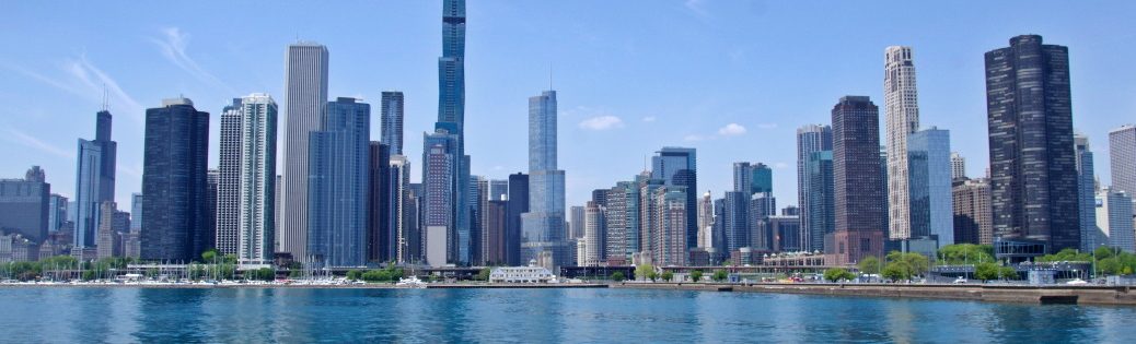
Ich bin schon mehrfach von einer Platte auf die andere gewechselt: u.a. auf meinen Reisen nach San Francisco und Los Angeles. Und wenn man weiß, wo die der Graben verläuft, kann man ihn nicht nur sofort auf einer Karte erkennen, sondern auch in der Landschaft erahnen.

San Juan Bautista — Die Reise beginnt auf H-1 in Richtung Norden. Wie auf einer Fahrt nach San Francisco geht es zunächst auf kurz H-156 und dann auf den H-101. Der Weg führt durch Berge und dann zweigt der Ostteil des H-156 ab. Gleich dahinter passiere ich den San Andreas Graben. Man erkennt nichts.

In San Juan Bautista gibt es ein Straßenfest. Verdammt. Mein Zeitplan ist heute so eng, dass ich keine Chance habe, es zu besuchen. Mein Ziel ist die Mission San Juan Bautista25. Die Kapelle befindet sich fast genau auf dem Graben.

Pinnacles National Park — Ich verlasse die Stadt auf H-156 in Richtung Hollister. Dann geht es auf H-25 gen Süden. Die Straße folgt dem San Andreas Graben und wechselt dabei mehrere Male die Kontinentalplatte. Der erste Wechsel ist auf Höhe des Willow Creek Cemetery. Hier kreuzt die Straße einen kleinen Fluss. Ich kann mir gut Vorstellen, dass der Fluss im San Andres Graben liegt.

Ein paar Meilen später erreiche ich die Einfahrt zum National Park. die Warteschlange ist lang. Es könnte gut eine Stunde dauern, bis ich einen Parkplatz habe. Ich gebe schnell auf.

Warum wollte ich hierher? Die Berge im Pinnacles National Park sind vulkanischen Ursprungs und etwa 23 Millionen Jahre alt. Es ist aber nur die Hälfte des Vulkans. Die andere Hälfte ist immer noch in der Nähe von Los Angeles; der Neenach Vulkan

Auf nach Parkfield — Weiter geht es auf  H-25. Mein nächstes Ziel ist Parkfield. Kurz unter dem Nationalpark verläuft der H-25 fast genau auf der Verwerfung. Die Landschaft ist einmalig.  Verkehr ist kaum vorhanden, so kann ich immer wieder anhalten und Fotos machen.

H25 endet am H198, aber der Weg nach Parkfiled Junction ist gesperrt. Rechts geht es nach San Lucas, zurück zum H101; ein 30 km Umweg. Keine Ahnung ob Peach Tree Road eine bessere Wahl ist. Ich probiere es einfach. Ich hoffe, dass es irgendwo einen Abzweiger gibt, den google nicht anzeigt und der keine Privatstraße ist. Bis dahin genieße ich die Landschaft.

Es gibt keinen Abzweiger. Ich muss runter bis kurz vor H-101 auf Höhe San Miguel. Hier kann ich von der Indian Valley Rd auf die Vineyard Canyon Rd abzweigen, die mich zurück nach Parkfield bringt. Es geht steil bergauf von 760 ft rauf auf 2400 ft (500 Höhenmeter). Ich bin jetzt 730 m ü.N.N. Oben angekommen geht es rechts ab, direkt nach Parkfield.

Parkfield — Warum Parkfield? Dieser Ort hat eine Brücke direkt über den San Andreas Graben. Und für alle Nerds gibt es auf beiden Seiten der Brücke ein Hinweisschild: Entering North Amercian Plate bzw. Entering Pacific Plate.

Ich laufe mehrfach über die Brücke. Wechsel von einer tektonischen Platte der Erdkruste auf die andere. Stehe in der Mitte. Dann gehe ich kurz runter zum Fluss. Ja, es wird nasse Füße geben, aber ich muss es versuchen: Gleichzeitig auf zwei tektonischen Platten stehen. Vielleicht habe ich das schon vorher. Aber hier bin ich mir 100% sicher, dass ich direkt auf dem San Andreas Graben stehe.

James Dean Junction — Ich folge der Cholame Rd, die der Verwerfung folgt, bis sie an am H-41/H-46 endet. Nach halber Strecke kommt wieder eine Sperrung. Dieses Mal ignoriere ich die Warnung. Die Straße ist vom Cholame Creek überflutet. Es sieht aber nicht tief aus. Ich riskiere es. Ich fahre jetzt nicht zurück und verliere knapp 2 Stunden. Der Highway ist nur 3 km entfernt. Zwei Regeln: Kein Wasser in den Luftfilter bekommen (also nicht zu schnell, damit eine Bugwelle den Motorraum flutet) und genug Drehzahl, damit der Auspuff nicht voll Wasser läuft.

Am Highway angekommen stehe ich nur weniger Meter entfernt von James Dean Junction, der Kreuzung an der der Schauspieler mit seinem Porsche tödlich verunglückte.

Bitterwater Rd — Ich fahre ein 2 Meilen in Richtung H-101 zur Bitterwated Rd. Die Straße liegt für einige Kilometer fast genau auf der Verwerfung. Und ich kenne diese Straße. WinterOwl und ich haben sie damals auf dem Weg nach LA benutzt, als wir den Stau umfahren haben. Irgendwann verlässt die Straße den Graben und biegt nach Süden ab. Danach geht es auf H-58 zwischen riesigen Solaranlagen hindurch nach Simmler. Hier ist nichts los. Aber die Straße folgt mit rechtwinkeligen Kurven ein unsichtbaren Schachbrett (man kann es auf google maps erkennen). Die Region ist komplett flach. Ich bin auf der pazifischen Kontinentalplatte. Am Horizont sehe ich die Berge, die durch die Kollision mit der nordamerikanischen Platte aufgeschoben hat.

Wallace Creek — Kurz bevor die Straße in diese Berge führt zweige ich zum Wallace Creek Interpretive Trail ab Er liegt in der Carrizo Plain nahe Soda Lake. Der Parkplatz ist etwa 200m vom Ende er pazifischen Platte entfernt. Die Steigung die ich sehe ist bereits auf der nordamerikanischen Platte. Ich weiß nicht, wie ihr das seht, aber ich finde die Idee cool. Ich befinde mich auf einer anderen Kontinentalplatte als der Aussichtspunkt, zu dem ich jetzt wandere.

Ich bin wegen eines Flusslaufes hier, der von einer Platte auf die andere fließt. Der Teil auf der pazifischen Platte verschiebt sich natürlich mit 6 cm pro Jahr26. Das hat dazu geführt, dass der Fluß direkt auf der Verwerfung nach rechts abknickt, um etwa 20 m später nach links knickt, um dem verschobenen Flusslauf zu folgen. Ich habe das in google Maps von oben gesehen. Aber es etwas völlig anderes, es live zu sehne. Das ist Plattentektonik eindrucksvoll visualisiert.

Und rein statistisch bewegt sich auf mein Auto gerade mit 6 cm pro Jahr an mein Standpunkt vorbei gen Norden.

Elkorn Scenic Overview — So langsam wird die Zeit knapp, bzw. das Sonnenlicht. Ich will es mindestens bis zum Tejon Pass schaffen. Mit für die Straßenverhältnis hoher Geschwindigkeit (30-40 km/h) folge ich der Elkhorn Rd die parallel zu Verwerfung (etwa 1 km entfernt auf der nordamerikanischen Platte) folgt. Links von mir sind Berge. Sie sehen faltig aus, wie ein Teppich, den man zusammengeschoben hat. Das Navi sagt, dass ich eine Stunde bis zum Elkorn Scenic Overview brauche. Mal sehen, ob ich die Zeit unterbieten kann, und wenn ja um wie viel. Jedes Mal, wenn ich glaube, etwas schneller fahren zu können, sehe ich riesige Schlaglöcher. Wenn ich eines davon übersehe kann ich ernsthaft die Radaufhängung oder die Felge zerlegen. Und ich habe keine Ahnung wie ich AAA (die US-Version des ADAC) beibringen kann, wo ich bin. Mobilfunknetz ist auch Null. Endlich bin ich an der Elkhorn Grade Rd. Zeit sieht gut aus. Der Wagen ist noch in einem Stück.

Auf zur Interstate 5 — Am Lookout angekommen ist der Blick etwas … sagen wir, ich hatte mehr erwartet. Ich schaue hinunter ins Central Valley. Jetzt geht es durch die Bergkette auf der nordamerikanischen Seite der Verwerfung und hinunter ins Central Valley. Der Lookout lag auf 2.400 ft. Maricopa, der Ort am Fuß der Berge liegt auf 800 ft. Es geht also knapp 500 Höhenmeter bergab. Unten angekommen sind die Berge hinter mir und vor mir ist alles flach. Und der H-166 ist geht stur geradeaus. 35 km ohne eine einzige Kurve, nicht einmal eine Bodenwelle. Nach den hochkonzentrierten 90 Minuten, die hinter mir liegen, kann ich etwas Langeweile gebrauchen.

Links sehe ich Ölfelder. Rechts die Berge der zusammengeschobenen nordamerikanschen Platte. Der San-Andreas-Graben macht hier einen Schwenk, sodass die Platte nicht gut aneinander vorbeigleiten, sondern auch zusammengschoben werden, wodurch sich die Berge aufgetürmt haben, die Los Angeles von Central Valley trennen.

Auf der I-5 angekommen wird die Zeit nun wirklich knapp. Bald ist Dämmerung. Ich fahre Richtung LA. Und es geht bergauf. Der Tejon Pass liegt auf 4200 ft (1280 m über N.N.). Die Berge selbst kratzen an der 4800er-Marke.

Tenjon-Pass — Das ist dann meine letzte Station. Die Dämmerung setzt ein. Einen Abstecher zum Frasier Park schaffe ich nicht mehr. Aber der Tenjon-Pass ist ein guter, krönender Abschluss. Wenn man die I-5 verlässt und auf die Ralphs Ranch Rd wechselt, kann man direkt am Tejon Pass anhalten und sich anschauen, wie zwei Kontinentalplatten aufeinander liegen.

Kein Witz. Hier kann man wirklich sehen, wie sich die Pazifikplatte auf die nordamerikanische Platte geschoben hat. Das Gestein der geologisch älteren Pazifikplatte ist gräulich und liegt auf dem ockerfarbenen Gestein der nordamerikansichen Platte, die geologisch jünger ist.

Von hier zum Neenach-Vulkan sind es etwa 35 km. Wie weiter oben erwähnt ist dies der fehlende Teil vom Pinnacle-Vulkan, der etwa 320 km entfernt ist.

Rückreise — Das heißt auch, dass vor mir noch weit über 320 km  Heimreise sind.  Das Navi sagt 400 km. Ich überlege kurz, ob ich mir ein Motel schnappen soll. Verdammt. Geht nicht. Heute ist Sonntag. nach einem Tankstop. Und Gegessen habe ich heute auch noch nichts. Ich hole mir ein paar Burger bei Wendy’s. Aus irgendeinem Grund sind die Burgerpatties quadratisch. Gestärkt und mit Dr.Pepper ausgerüstet geht es auf die Heimreise.

Erst 73 Meilen (1 Stunde) auf der I-5 an Bakersfield vorbei bis Lost Hill und dann 64 Meilen (1 Stunde) auf den H-46 bis El Paso de Robles. So langsam werde ich müde. Jetzt kommen die 90 Meilen (1.5 Stunden) auf H-101.  All diese Entfernungen klingen so kurz. Aber mit dem Ansatz 60 Meilen in 60 Minuten kann man gut umrechnen. Und auf einmal fühlen sich 90 Meilen lang an.

Endlich erreiche ich den Abzweiger in Salinas. jetzt ist es wie Hamburg-Lübeck. Heimattrecke. Endspurt. Ich habe es geschafft. Ich bin daheim. Was für ein Tag. Die Landschaft war so unterschiedlich. Das Wetter war genial. Sonnenschein pur. Und ich glaube viel mehr kann man vom San-Andreas-Graben nicht erwarten. Ich habe sicherlich ein paar Orte übersehen. Und um alles nördlich von San Juan Bautista kümmere ich mich an einem anderen Tag.

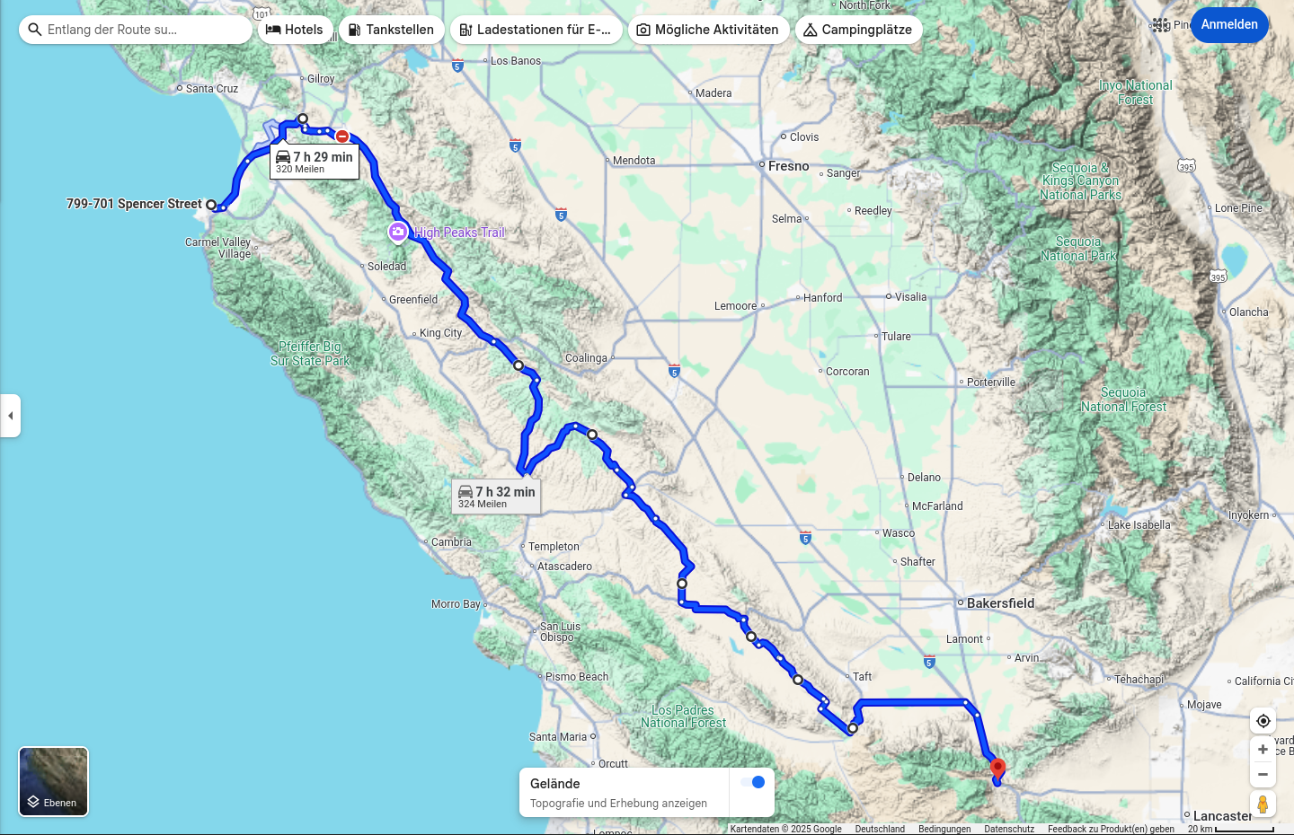
Nach Tacho waren es 320 Meilen bis zum Tejon-Pass und 255 Meilen zurück. Das macht umgerechnet 925 km. WOW. Viel mehr war wirklich nicht drin.

ENG

I’ve switched from one slab to another several times, including on my trips to San Francisco and Los Angeles. And if you know where the trench runs, you can not only recognize it immediately on a map, but also sense it in the landscape.

San Juan Bautista — The journey begins on H-1 heading north. As on a trip to San Francisco, you first take the short H-156 and then the H-101. The road leads through mountains and then the eastern part of H-156 branches off. Just behind it, I pass the San Andreas Fault. You can’t recognize anything.

There’s a street party in San Juan Bautista. Damn. My schedule is so tight today that I don’t have a chance to visit it. My destination is Mission San Juan Bautista27. The chapel is located almost exactly on the moat.

Pinnacles National Park — I leave the city on H-156 in the direction of Hollister. Then I head south on H-25. The road follows the San Andreas Fault and changes the continental shelf several times. The first change is at Willow Creek Cemetery. Here the road crosses a small river. I can well imagine that the river lies in the San Andreas Fault.

A few miles later I reach the entrance to the National Park. The queue is long. It could take an hour to find a parking space. I quickly give up.

Why did I want to come here? The mountains in Pinnacles National Park are of volcanic origin and are around 23 million years old. But it’s only half of the volcano. The other half is still near Los Angeles; the Neenach Volcano.

Off to Parkfield — Continuing on H-25, my next destination is Parkfield. Just below the national park, H-25 runs almost exactly on the fault line. The landscape is unique. There is hardly any traffic, so I can always stop and take photos.

H-25 ends at H-198, but the road to Parkfiled Junction is closed. Turn right to San Lucas, back to H-101; a 30 km detour. No idea whether Peach Tree Road is a better choice. I’ll just give it a try. I hope there’s a turnoff somewhere that google doesn’t show and that isn’t a private road. Until then, I enjoy the scenery.

There is no turn-off. I have to go down to just before H-101 at San Miguel. Here I can turn off Indian Valley Rd onto Vineyard Canyon Rd, which takes me back to Parkfield. The road climbs steeply from 760 ft up to 2400 ft (500 vertical meters). I am now 730 m above sea level. At the top I turn right, directly to Parkfield.


Parkfield — Why Parkfield? This place has a bridge directly over the San Andreas Fault. And for all the nerds, there is a sign on both sides of the bridge: Entering North American Plate and Entering Pacific Plate.

I cross the bridge several times. Switch from one tectonic plate of the earth’s crust to the other. Stand in the middle. Then I walk briefly down to the river. Yes, my feet will get wet, but I have to try: Stand on two tectonic plates at the same time. Maybe I’ve done it before. But here I’m 100% sure that I’m standing directly on the San Andreas Fault.

James Dean Junction — I follow Cholame Rd, which follows the fault until it ends at H-41/H-46. Halfway there is another closure. This time I ignore the warning. The road is flooded by Cholame Creek. But it doesn’t look deep. I take the risk. I don’t go back now and lose almost 2 hours. The highway is only 3 km away. Two rules: Don’t get any water in the air filter (so don’t go too fast so that a bow wave floods the engine compartment) and rev enough so that the exhaust doesn’t fill up with water.

When I reach the highway, I’m only a few meters away from James Dean Junction, the intersection where the actor had a fatal accident in his Porsche.

Bitterwater Rd — I drive 2 miles towards H-101 to Bitterwated Rd. The road is almost exactly on the fault for a few miles. And I know this road. WinterOwl and I used it on the way to LA back when we were avoiding the traffic jam. At some point, the road leaves the ditch and turns south. Then it goes on H-58 between huge solar plants to Simmler. There is nothing going on here. But the road follows an invisible checkerboard with right-angled bends (you can see it on google maps). The region is completely flat. I am on the Pacific continental plate. On the horizon I can see the mountains that have been pushed up by the collision with the North American plate.

Wallace Creek — Just before the road enters these mountains, I turn off to the Wallace Creek Interpretive Trail, located in the Carrizo Plain near Soda Lake. The parking lot is about 200 m from the end of the Pacific Plate. The incline I see is already on the North American Platte. I don’t know about you guys, but I think it’s a cool idea. I’m on a different continental plate than the viewpoint I’m hiking to now.

I’m here because of a river course that flows from one plate to the other. The part on the Pacific plate naturally shifts at 6 cm per year28. This caused the river to bend to the right directly on the fault, only to bend to the left about 20 meters later to follow the shifted course of the river. I saw this in google maps from above. But it’s something completely different to see it live. This is plate tectonics impressively visualized.

And in purely statistical terms, my car is moving north past my point of view at a rate of 6 cm per year.

Elkorn Scenic Overview — Time is running out, or rather the sunlight. I want to make it at least as far as Tejon Pass. At a high speed for the road conditions (30-40 km/h) I follow the Elkhorn Rd which runs parallel to the fault (about 1 km away on the North American plate). There are mountains to my left. They look wrinkled, like a carpet that has been pushed together. The GPS says it will take me an hour to reach the Elkorn Scenic Overview. Let’s see if I can beat that time, and if so, by how much. Every time I think I can drive a little faster, I see huge potholes. If I miss one of them, I could seriously break the suspension or the rim. And I have no idea how to tell AAA (the US version of ADAC) where I am. Cell service is also zero. I’m finally at Elkhorn Grade Rd. Time looks good. The car is still in one piece.

Off to Interstate 5 — Arriving at the lookout, the view is a bit … Let’s say I was expecting more. I look down into the Central Valley. Now it goes through the mountain range on the North American side of the fault and down into the Central Valley. The lookout was at 2,400 ft. Maricopa, the town at the foot of the mountains, is at 800 ft. So it’s almost 500 meters downhill. At the bottom, the mountains are behind me and everything in front of me is flat. And the H-166 is stubbornly straight ahead. 35 km without a single bend, not even a bump. After the highly concentrated 90 minutes that lie behind me, I could do with some boredom.

On the left I see oil fields. On the right, the mountains of the collapsed North American plate. The San Andreas Fault makes a turn here, so that the plates are not just sliding past each other, but are also being pushed together, causing the mountains that separate Los Angeles from the Central Valley to pile up.

Once on the I-5, time is really running out. It will soon be dusk. I drive towards LA. And it’s uphill. The Tejon Pass lies at 4200 ft (1280 m above sea level). The mountains themselves are scratching at the 4800 m mark.

Tenjon Pass — This is my last stop. Dusk is setting in. I don’t manage a detour to Frasier Park. But Tenjon Pass is a good, crowning finale. If you leave I-5 and change to Ralphs Ranch Rd, you can stop right at Tejon Pass and see how two continental plates lie on top of each other.

No joke. Here you can really see how the Pacific plate has pushed onto the North American plate. The rock of the geologically older Pacific plate is greyish and lies on the ochre-colored rock of the North American plate, which is geologically younger.

It is about 35 km from here to the Neenach volcano. As mentioned above, this is the missing part of the Pinnacle volcano, which is about 320 km away.

Return journey — This also means that I still have well over 320 km to go home. The sat nav says 400 km. I briefly consider whether I should grab a motel. Damn. I can’t. Today is Sunday. after a refueling stop. And I haven’t eaten anything today either. I grab a couple of burgers at Wendy’s. For some reason the burger patties are square. Strengthened and equipped with Dr. Pepper, I set off on my journey home.

First 73 miles (1 hour) on the I-5 past Bakersfield to Lost Hill and then 64 miles (1 hour) on the H-46 to El Paso de Robles. I’m starting to get tired. Now comes the 90 miles (1.5 hours) on H-101. All these distances sound so short. But with the 60 miles in 60 minutes approach, it’s easy to do the math. And suddenly 90 miles feels like a long time.

Finally I reach the junction in Salinas. Now it’s like Hamburg-Lübeck. Home stretch. Final spurt. I have made it. I’m home. What a day. The landscape was so different. The weather was brilliant. Pure sunshine. And I don’t think you can expect much more from the San Andreas Fault. I certainly missed a few places. And I’ll deal with everything north of San Juan Bautista another day.

According to the speedometer, it was 320 miles to the Tejon Pass and 255 miles back. That’s the equivalent of 925 km. WOW. There really wasn’t much more in it.