Am Wochenende ist Frolic in San Francisco. Eine Furry-Party im SF Eagle, und eine gute Gelegenheit für ein Wochenende an der Golden Gate Bridge. WinterOwl bietet sich als Fahrgelegenheit an. Er will sowieso in die Richtung.
Das Timing könnte nicht besser und gleichzeitig nicht schlechter sein. Es regnet seit Anfang der Woche, hier in Monterey und auch in San Francisco. Ein Wetterwechsel ist nicht in Sicht. Schlecht. Allerdings hat Monterey seit Donnerstag keine Strom mehr. Laut Webseite von PGE könnte es einige Tage (!) dauern, bis alles wieder läuft. Monterey steht still. San Francisco klingt da attraktiver.
WinterOwl holt mich noch vorm Mittag ab. Arbeit fällt aus. Wir stoppen in Seaside. Hier gibt es Strom und Mittagessen. Wir erreichen San Francisco spät, keiner hetzt uns. Ich teste kurz den Weg zum SF Eagle, damit ich morgen nicht verlaufe. Die Kamera bleibt im Hotel. Ich traue der Gegend nicht; nicht bei Nacht. Nur unweit vom SF Eagle ist das Kneipenviertel in der Mission St. Eine coole Kneipe finde ich nicht, also gehe ich zurück zum Hotel.

–
Projection: Mercator (5)
FOV: 124 x 90
Ev: 11,24
Samstag, 11. März 2023
Es regnet. Ich kann es nicht ändern. Mit Kamera und Regenjacke geht es los. Erster Stopp ist City Hall, denn es gleich neben meinem Hotel. Am War Memorial Opera House vorbei geht es dann die Grove St entlang zum Alamo Square. Hier stehen die Painted Ladies, bunt gestrichene Häuser im viktorianischen Stil. Viele kennen den Park und die Häuser vermutlich aus der 1980er Sitcom Full House, ohne es zu wissen.
Von hier geht es nach Japan Town; irgendwo bei Webster St and Geary Blvd. Leider erinnert mich hier nichts an Japan. Ich hatte mehr erwartet. Hinter den Markthallen mit japansichen Geschäften finde ich den Japantown Peace Plaza mit einer Betonpagode. Es startet eine kleine Fußgängerzone. Hier sieht es ein wenig japanisch aus. Ich glaube mehr wird es nicht mehr. Da es Zeit für Mittagessen ist, steuere ich das Ramen Yamadaya an.
Nun folge ich der California St (mit kurzem Abstecher zum Lafayette Park). Ich kann nicht glauben wie viele Berge San Francisco hat. Es geht ständig steil bergauf oder steil bergab. Argh. Ich beschwere mich nie wieder über Vallendar.
Ich finde die Endstation einer Cable Car-Strecke CA. Hier sind keine Touristen. Beste Gelegenheit für eine Fahrt auf dem Trittbrett. Und ich bekomme einen guten Tipp: die Muni-App und ein Tagesticket, es ist günstiger als einzelne Ticket unten an der Touristenfalle, wo das Tagesticket nicht angeboten wird.. Hah. Das spart eine Menge Geld.
Die Cable Car werden durch ein Seil unter der Straße bewegt. In der Mitte des Cars greift eine Kralle nach unten in das Seil. Der Fahrer hat einen großen Hebel für die Kralle und einen zweiten, um die Bremse zu betätigen. Die Kralle hat den Vorteil, dass das Seil dauerhaft in Bewegung ist und das Cable Car sich davon unabhängig mit dem Verkehr bewegen oder Passagiere ein- und aussteigen lassen kann. Clever.
An der Kreuzung California St / Powell St kreuzen sich zwei Strecken. Keine Ahnung wie die das mit den sich kreuzenden Seilen koordinieren. Ich steige aus. Foto-Time. Die California St geht von hier aus steil bergab. In Verlängerung sehe ich die Oakland Bay Bridge. Danach fahre ich Trittbrettfahrer weiter zur Filbert St. Es soll eine der steilsten Straßen in San Francisco sein und ich werde nicht enttäuscht. Sie ist so steil, dass der Fußweg als Treppe gebaut ist.
Nur zwei Straßen entfernt ist die berühmte Lombard Street. Hier schlängelt sich die Straße in kleinen Serpentinen steil den Berg hinab. In Verlängerung sehe ich den Coit Tower. Den hebe ich mir für morgen auf und folge der Hyde St runter zum Hafen. Den letzten Stopp für heute. Die Golden Gate Bridge ist in tiefen Wolken verhüllt und kaum auszumachen. Hatte ich erwähnt, dass es seit der Mittagspause kaum geregnet hat?
Der Hafen ist Touristengebiet. Hier im Hafen liegen Boote für Rundfahrten und Hochseeangeln. Eines der Boote, so erfahre ich, startet in etwa 20 Minuten. Ich verspreche, dass ich gleich wieder da bin. Ich brauche Proviant und Bargeld für das Ticket. In Kalifornien sind „Open Container“ verboten. Das Boot ist aber Privatgelände.
Mit zwei Bier und Bargeld bin ich pünktlich zur Abfahrt wieder am Boot. Der Regen ist auch pünktlich. Super. Hatte ich nicht gerade noch erwähnt … egal. Ich stehe am Bug und wir fahren los. Neben mir gibt es nur zwei andere Fahrgäste, die in der Kabine verweilen. Ich bin ein Nordlicht. Das brauche ich jetzt: Regen, ein Boot, Möwen, Wind.
Die Golden Gate Bridge ist kaum auszumachen. Egal. Der Kapitän hält mich sicherlich für verrückt. Egal. Wir fahren auch an Alcatraz vorbei. Die Fotos sind nicht die Besten, aber mehr ist bei diesem Wetter nicht zu machen.
Nach der Bootsfahrt geht es zurück. Es wird dunkel. Ich brauche Abendessen und heute Abend ist noch die Frolic-Party. An der Endstation der Cable Car (Linie PH) steht eine lange Schlange von Touristen. Hier warte ich bestimmt eine Stunde. Ich gehe rüber zur anderen Strecke (PM) und dann noch zwei Haltestellen entlang der Strecke. Keine Wartezeit. Ich fahre runter bis zur Endstation an der Market St. Hier warten wieder dutzende Touristen auf eine Fahrt.
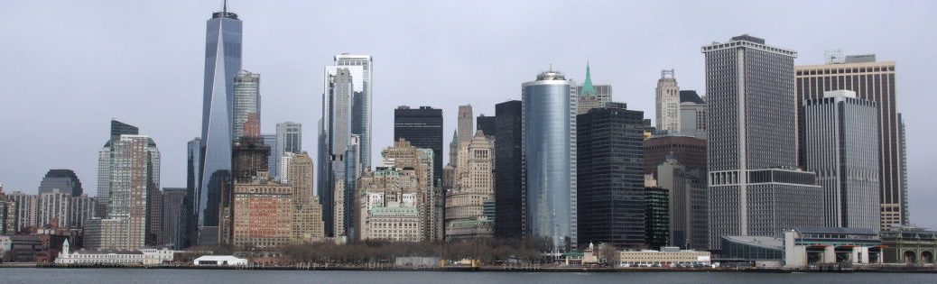
Market St. ist zwischen hier (5th St) und meinem Hotel (8th St) keine gute Gegend. Dutzende Obdachlose und Drogenabhängige. Und ich befürchte, dass nicht alle „Tretminen“ von Hunden sind. Die Sicht, die sich mir hier bietet, hatte ich von New York erwartet. Eine Gesellschaft im Verfall; ein Staat, der in sozialen Belangen versagt. Und es erklärt viel Filme der 80er Jahre: Judge Dredd, Robocop, … Die sind am Ende nur konsequent 5-10 Dekaden weitergedacht.
Frolic Furry Party
Da ich dem Wetter nicht traue, bleibt Gyoji im Koffer. Nur der Tail kommt mit. Ich gehe zum SF Eagle. Ich hätte das Kleingedruckte lesen sollen. Das SF Eagle ist eine Gay Bar für Leather Boys und Bears. Erinnert ihr euch an die Blue Oyster Bar in Police Academy? Ja, genau so. Genau so. Das hatte ich nicht erwartet. Furryparty in einem Leather Club. Und es funktioniert. Und ich muss zugegeben: Einige der Leather Boys sind echt durchtrainiert. Da bin ich keine Konkurrenz. Ich muss wieder mehr ins Fitness Studio.
Die Party ist super. Meine Smartphonekamera hatte keine Chance für gute Bilder, daher zwei Fotos, die ich von der Frolic-Webseite „geklaut“ habe. Irgendwann gegen drei Uhr und einen Late-Night-Burrito vom Food Truck später bin ich wieder im Hotel.
Frolic is in San Francisco this weekend. A Furry party at the SF Eagle, and a good opportunity for a weekend at the Golden Gate Bridge. WinterOwl offers himself as a ride. He’s heading that way anyway.
The timing couldn’t be better and at the same time couldn’t be worse. It’s been raining since the beginning of the week, both here in Monterey and in San Francisco. There’s no change in the weather in sight. Bad. However, Monterey has been without power since Thursday. According to the PGE website, it could be a few days (!) before everything is back up and running. Monterey is at a standstill. San Francisco sounds more attractive.
WinterOwl picks me up before noon. Work is canceled. We stop in Seaside. There’s electricity and lunch here. We reach San Francisco late, no one is rushing us. I briefly test the way to SF Eagle so that I don’t get lost tomorrow. The camera stays at the hotel. I don’t trust the area; not at night. Not far from the SF Eagle is the pub district on Mission St. I can’t find a cool pub, so I head back to the hotel.
–
Projection: Mercator (5)
FOV: 124 x 90
Ev: 11,24
Samstag, 11. März 2023
It’s raining. I can’t change it. I set off with my camera and rain jacket. My first stop is City Hall, which is right next to my hotel. I walk past the War Memorial Opera House along Grove St to Alamo Square. Here are the Painted Ladies, colorfully painted Victorian-style houses. Many people probably know the park and the houses from the 1980s sitcom Full House without realizing it.
From here it goes to Japan Town; somewhere at Webster St and Geary Blvd. Unfortunately, nothing here reminds me of Japan. I had expected more. Behind the market halls with Japanese stores, I find the Japantown Peace Plaza with a concrete pagoda. A small pedestrian zone starts here. It looks a little Japanese here. I don’t think it will be much more. As it’s time for lunch, I head for the Ramen Yamadaya.
Now I follow California St (with a short detour to Lafayette Park). I can’t believe how many hills San Francisco has. It’s always steeply uphill or steeply downhill. Argh. I’ll never complain about Vallendar again.
I find the terminus of a CA cable car route. There are no tourists here. Best opportunity for a ride on the footboard. And I get a good tip: the Muni app and a day pass, it’s cheaper than a single ticket down at the tourist trap, where the day pass is not offered.. Hah. That saves a lot of money.
The cable cars are moved by a rope under the road. In the middle of the car, a claw reaches down into the rope. The driver has a large lever for the claw and a second one to operate the brake. The claw has the advantage that the cable is permanently in motion and the cable car can move independently of the traffic or allow passengers to get on and off. Clever.
Two routes cross at the junction of California St and Powell St. I have no idea how they coordinate this with the crossing cables. I get off. Photo time. California St goes steeply downhill from here. As an extension, I can see the Oakland Bay Bridge. Afterwards, I continue pedaling to Filbert St. It’s supposed to be one of the steepest streets in San Francisco and I’m not disappointed. It’s so steep that the footpath is built as a staircase.
Just two streets away is the famous Lombard Street. Here the road winds steeply down the hill in small hairpin bends. As an extension, I can see the Coit Tower. I save it for tomorrow and follow Hyde St down to the harbor. The last stop for today. The Golden Gate Bridge is shrouded in deep clouds and barely visible. Did I mention that it has hardly rained since lunchtime?
The harbor is a tourist area. Boats for round trips and deep-sea fishing are moored here. I am told that one of the boats will be leaving in about 20 minutes. I promise to be right back. I need provisions and cash for the ticket. In California open containers are prohibited. However, the boat is private property.
With two beers and cash, I’m back at the boat in time for departure. The rain is also on time. Great. Didn’t I just mention that … Never mind. I stand at the bow and we set off. Apart from me, there are only two other passengers in the cabin. I am a northern light. That’s what I need now: rain, a boat, seagulls, wind.
The Golden Gate Bridge is barely visible. No matter. The captain must think I’m crazy. Never mind. We also sail past Alcatraz. The photos aren’t the best, but that’s all we can do in this weather.
After the boat trip we head back. It’s getting dark. I need dinner and tonight is the Frolic party. There is a long queue of tourists at the terminus of the cable car (PH line). I must wait here for an hour. I walk over to the other line (PM) and then two more stops along the line. No waiting time. I ride down to the terminus at Market St. Here again, dozens of tourists are waiting for a ride.
Market St. is not a good neighborhood between here (5th St) and my hotel (8th St). Dozens of homeless people and drug addicts. And I’m afraid that not all of them are dog “step mines”. The view I get here is what I expected from New York. A society in decay; a state that is failing in social matters. And it explains a lot of 80s movies: Judge Dredd, Robocop, … In the end, they are just consistently thought 5-10 decades ahead.
Frolic Furry Party
As I don’t trust the weather, Gyoji stays in the suitcase. Only the tail comes with me. I go to the SF Eagle. I should have read the small print. The SF Eagle is a gay bar for leather boys and bears. Remember the Blue Oyster Bar in Police Academy? Yeah, just like that. Exactly like that. I wasn’t expecting that. Furry party in a leather club. And it works. And I have to admit: Some of the Leather Boys are really well-trained. I’m no competition there. I need to go back to the gym more.
The party is great. My smartphone camera didn’t have a chance to take any good pictures, so I “stole” two photos from the Frolic website. Sometime around three o’clock and a late-night burrito from the food truck later, I’m back at the hotel.


FOV: 18 x 12
Ev: 15,29")


FOV: 47 x 50
Ev: 13,64")


