2023 war ich für ein Jahre in den USA. Jetzt ist es Trumpistan.
Bleibt fern. Besucht lieber Kanada und Mexiko. — And: Don’t buy American.
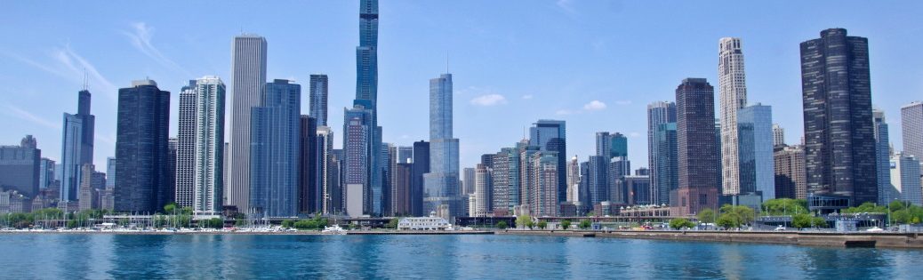
Der Wecker klingelt sehr früh. Zu früh. Hätte ich doch das spätere Shuttle buchen sollen. Die Stimme sagt nein. Nicht wirklich fit taumel ich runter zur Rezeption. Kaffe. Und dann ist da auch schon das Shuttle. Ab Flughafen angekommen erwartet mich Chaos. Es nicht einmal 5:30 Uhr. Die Warteschlage vor der Sicherheitskontrolle zieht sich durch die gesamte Abfertigungshallte. Das dauert mindestens eine Stunde. Das ist schlimmer als im Heidepark. Die Stimme hatte recht. Mit dem späten Shuttle hätte ich es niemals geschafft. Wir schlängeln uns durchs Gebäude. Dann die Kurve, es geht zurück. Polonese. Halbzeit. Jetzt, 20 Minuten später, ist das Ende bereits draußen, vor dem Gebäude. Wahnsinn. 330.000 Besucher. Gefühlt wollen alle jetzt nach Hause fliegen. 10 Minuten vor dem Boarding bin ich durch die Sicherheitskontrolle. Die Stimme bekommt gleich ein Bier ausgegeben. Ab jetzt bin ich entspannt. 4,5 Stunden Flug minus 2 Stunden Zeitverschiebung. Dann ein Mietwagen. Ich will u.a. nach Mussel Rock, zur Stanford Dish und dann Highway 1 runter und über Santa Cruz zurück nach Monterey. San Andreas Fault — Auf der I-280 geht es nach Norden, dann kurz auf den Highway 1, nur um in Fairmont sofort abzubiegen. Es geht runter zum Mussel Rock. Dies ist ein Felsen im Wasser, ein paar Meter entfernt vom Ufer. Er hat historische Bedeutung. Ich bin aber aus einem anderen Grund hier: Die San-Andreas-Verwerfung mündet hier in den Pazifik. Wo genau, das kann ich nicht erkennen. Ich bin der Meinung, dass die Küsten südlich leicht anders aussieht als nördlich. (Aber gilt auch für Travemünde Leuchtenfeld mit dem Kurstrand zur einen und dem Brodtner Steilufer zur anderen Seite.) Hier, nahe am Mussel Rock war das Epizentrum des schwere Erdbeben von 1906, das San Francisco zerstörte. Im Anschluss geht es zurück auf die I-280 und zum San Andreas Lake, der genau auf der San-Andreas-Verwerfung liegt. Ein paar Meilen südlich am Lower Crystal Springs Reservoir, das auch auf der Verwerfung liegt. Hier am Highway 35 ist ein Parkplatz. Foto-Zeit. Stanford Dish — Danach geht es weiter zum SLAC1. Mehr als ein Foto vom Eingang ist nicht drin, seite Corona gibt es keine öffentlichen Führungen mehr. Ich fahre weiter zur Standford University und laufe etwas über den Campus. Das Ding ist riesig. Und dann geht es zum Stanford Dish Hiking Trail. Ich finde einen Parkplatz in der Stanford Ave. Es ist heiß. Ich bin von gestern noch platt. Aber ein Plan ist ein Plan. Ich wandere los. Natürlich geht es erbarmungslos bergauf (Die Straße ist auf 190 ft Elevation, die Dish auf 440 ft). Aber das geht ja irgendwann auch wieder bergab. Es ist warm, sehr warm. Zugegeben, mit der Schlange die ungestört den Wanderweg kreuzt, habe ich nicht gerechnet. Ich glaube es ist eine Gophersnake. Die Landschaft ist eindeutig Kalifornien. Hügelig und sandfarben. Rechts ist das Sonnenobservatorium. Links der W6YX Radio Club mit seinen Antennen. Dahinter die kleine Stanford Dish, die schon seit einigen Jahren außer Betrieb ist und langsam verfällt. Der Weg macht eine langgezogene Rechtskurve. Die große Stanford Dish2 kommt in Sicht und wird größer und größer. Es wirkt wie eine CAE-Modell, wo nur die Kanten dargstellt werden, aber die Flächen fehlen. Ich folge dem Hiking Trail. Die Elevation bleibt endlich konstant. Nach 600 m folgt ein scharfer Rechtsknick und jetzt endlich geht es bergab. Links und rechts sehe Rehe, Truthähne und andere Tiere. Unten angekommen bleibt der Weg zurück zum Beginn des Wanderwegs. Natürlich geht es nochmals bergauf und wieder bergab. Am Frenchman’s Gate überlege ich kurz, ob ich runter auf die Straße wechsele. Nein. Der Ehrgeiz packt mich. Ich komplettiere die Runde. Dazu muss ich ein letztes Mal 80 ft Elevation hinauf. Ich brauche echt einen Drink. Ich laufe die 80 ft übringens nur rauf, um sie sofort wieder bergab zu laufen. Alles in Allem war es anstrengend, aber nach dem 4,5 Stunden Flug auch schön. Es bleibt die Rückreise nach Monterey. Da ich noch eine Menge Zeit übrig habe, fahre ich anstatt I-280 nach Südosten, rüber zum Highway 84. Er führt durch die Berge (es geht rauf auf fast 1600 ft) runter zur Pazifikküste. Hier wartet der Scenic Highway 1 auf mich. An etlichen Stränden vorbei geht es nach Santa Cruz. Ein Bier am Boardwalk kann ich mir nicht verkneifen. Die Dämmerung hat bereits begonnen. Es ist Zeit nach Monterey zu fahren. Abendessen wird sich finden. Das war mal ein Trip: Chicago, Milwaukee, das Alestorm-Konzert, Zugfahren, Indy 500 mit Bryan Adams-Konzert. Da war alles dabei. Morgen gebe ich den Mietwagen zurück und bin wieder auf der Arbeit. Schon in zwei Wochen fahre ich dann nach Los Angeles.
The alarm clock rings very early. Too early. I should have booked the later shuttle. The voice says no. Not really fit, I stagger down to reception. Coffee. And then there’s the shuttle. Arriving at the airport, chaos awaits me. It’s not even 5:30 am. The queue at the security checkpoint stretches through the entire check-in hall. It takes at least an hour. It’s worse than at Heidepark. The voice was right. I would never have made it on the late shuttle. We wind our way through the building. Then the bend, we head back. Polonese. Half time. Now, 20 minutes later, the end is already outside, in front of the building. Madness. 330,000 visitors. It feels like everyone wants to fly home now. I pass through security 10 minutes before boarding. The voice immediately hands me a beer. From now on I’m relaxed. 4.5 hours flight minus 2 hours time difference. Then a rental car. I want to go to Mussel Rock, the Stanford Dish and then down Highway 1 and back to Monterey via Santa Cruz. San Andreas Fault — Head north on I-280, then briefly onto Highway 1, only to turn off immediately in Fairmont. We head down to Mussel Rock. This is a rock in the water, a few meters from the shore. It has historical significance. But I’m here for a different reason: The San Andreas Fault flows into the Pacific here. I can’t see where exactly. I think that the coast looks slightly different to the south than to the north. (But this also applies to Travemünde Leuchtenfeld with the Kurstrand on one side and the Brodtner Steilufer on the other). Here, near Mussel Rock, was the epicenter of the massive 1906 earthquake that destroyed San Francisco. Then it’s back onto I-280 and to San Andreas Lake, which lies exactly on the San Andreas Fault. A few miles south at Lower Crystal Springs Reservoir, which is also on the fault. There is a parking lot here on Highway 35. Photo time. Stanford Dish — Then it’s on to SLAC3. More than a photo of the entrance is not possible, since Corona there are no longer any public tours. I drive on to Standford University and walk around the campus. This thing is huge. And then it’s off to the Stanford Dish Hiking Trail. I find a parking lot on Stanford Ave. It’s hot. I’m still flat from yesterday. But a plan is a plan. I set off on my hike. Of course, it’s relentlessly uphill (the road is at 190 ft elevation, the Dish at 440 ft). But eventually it goes downhill again. It’s warm, very warm. Admittedly, I didn’t expect to see the snake crossing the hiking trail undisturbed. I think it is a gophersnake. The landscape is definitely California. Hilly and sand-colored. On the right is the solar observatory. On the left is the W6YX Radio Club with its antennas. Behind it is the small Stanford Dish, which has been out of service for several years and is slowly falling into disrepair. The path makes a long right turn. The large Stanford Dish4 comes into view and gets bigger and bigger. It looks like a unfinished CAE model, where only the edges are shown, but the surfaces are missing. I follow the hiking trail. The elevation finally remains constant. After 600 m, there is a sharp bend to the right and now the trail finally starts to descend. Deer, turkeys and other animals can be seen to the left and right. At the bottom, the path leads back to the start of the hiking trail. Of course, it goes uphill again and downhill again. At Frenchman’s Gate, I briefly consider whether I should go down to the road. No. My ambition gets the better of me. I complete the lap. To do so, I have to climb 80 ft of elevation one last time. I really need a drink. Incidentally, I only run up the 80 ft to run downhill again straight away. All in all, it was exhausting, but also nice after the 4.5-hour flight. The return journey to Monterey remains. Since I still have a lot of time left, I drive southeast instead of I-280, over to Highway 84, which leads through the mountains (it goes up to almost 1600 ft) down to the Pacific coast. Scenic Highway 1 is waiting for me here. I pass several beaches on the way to Santa Cruz. I can’t resist a beer on the boardwalk. Dusk has already set in. It’s time to drive to Monterey. Dinner will be found. That was quite a trip: Chicago, Milwaukee, the Alestorm concert, train travel, Indy 500 with Bryan Adams concert. It was all there. Tomorrow I’ll return the rental car and be back at work. In two weeks‘ time I’ll be driving to Los Angeles.DEU


FOV: 73 x 27Ev: 13,32")


ENG